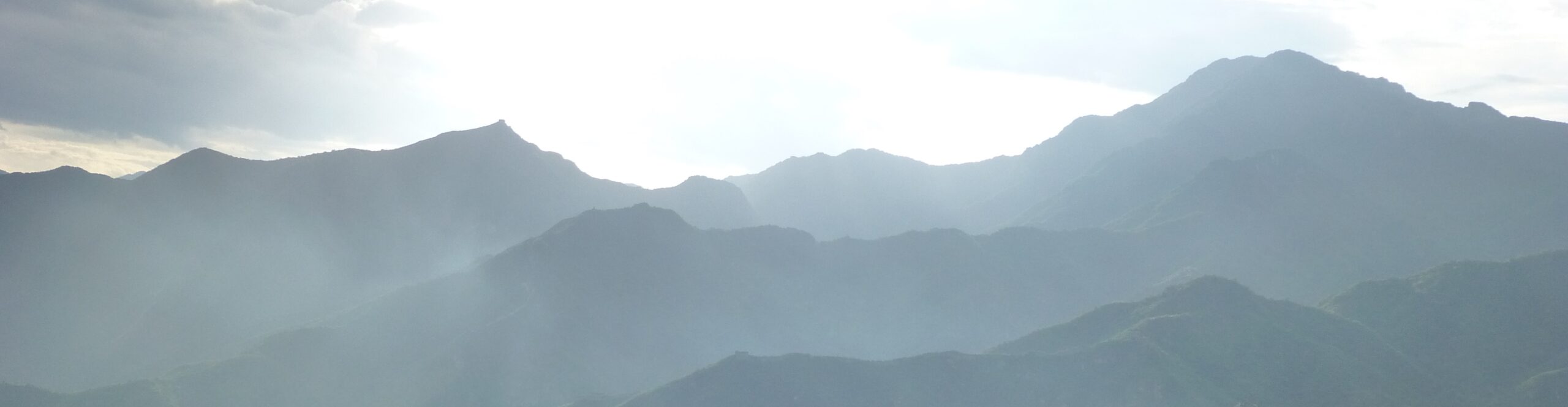

I think Jessica and I have an addiction problem. The hut-to-hut hiking in the Alps is just so incredible that we can’t stop ourselves from going back for more. We decided to try a new area this time: a loop around the Ortler Range in northern Italy. This is about 40 miles west of Bolzano, which we visited in 2021 and 2025, and less than 20 miles north of where we had hiked with John and Annie Rose near Sonico a week earlier.
To get there, we had to drive another several hours after dropping John and AR at the Milan airport. We zipped by the length of Lago di Como, one of Italy’s largest lakes, stopping for lunch and a view in Colico.

From there, we crept up through the foothills to our base of operations, Bormio, a ski town with nearby thermal springs just a few miles from Switzerland’s far eastern border.
In many ways Bormio was much like several of the other Swiss, Austrian, or Italian mountain towns we’ve been to — narrow cobbles streets, heavy old stone buildings mixed with more modern residential architecture, lots of tourist infrastructure, etc.


But, one thing was missing: German. Everywhere else we had been in that chunk of the Alps was either exclusively German-speaking or had a mix of Italian and German. But Bormio didn’t even have German on menus as a secondary option. It was a strictly Italian-speaking place, just miles from Switzerland and not far from the border of South Tyrol (the Italian province just to the east, where Bolzano is located). Unfortunately, we didn’t have time to explore much there — we ate, loaded up on hiking snacks, and re-packed for a week of hiking.
The next morning, since we had a car (an unexpected change of plans due to a railway workers strike, see previous post) we decided to use it to cut a few miles and a thousand feet of descent off our last day of hiking. I drove to where our trail was supposed to end and, after some adventures in trying to find parking in the little towns clinging to the hillside, I took the bus back to Bormio to catch up with Jessica.
That bus ride wasn’t a Peruvian Andes level of insanity, but it was pretty close. The bus twisted and turned down the steep road from Paris (yes, I parked in Paris – it’s a tiny collection of houses just below Niblogo) to San Nicolo. That wasn’t too bad, as it was paved the whole way, but it didn’t help my confidence that a trainee was behind the wheel with the regular bus driver occasionally reminding him of things in Italian (so I don’t know how urgent they were). He definitely missed at least one stop. I was the only passenger, and there was no one waiting, so it wasn’t a big deal, but he definitely got scolded for that. From there, it should have gotten easier, as we left the one lane mountain roads and we got on the main “highway” back to Bormio. But, no. Instead, we had to pass through the tiny town of Uzza which was clearly built before 18 wheelers had been invented. Trying to get two buses through this town was an exciting adventure enacted at a snail’s pace. Luckily, that encounter happened where there was a tiny park on one side of the road rather than 10 feet further in either direction up or down the road…

Anyhow, I got back to Bormio in one piece, just with a little more excitement than expected. Jess and I then turned right around and hopped on a bus headed the other direction out of town to start our hike.
Our plan, overall, was to do the Ortler High Mountain Trail, a 70-something mile loop around the Ortler Alps. However, in order to accommodate some route alterations and our overall timing, we decided to cut off about 2 days of the loop — the part that goes through Bormio — and make a few other changes. So, our first day, we decided we’d base our route off the amount of time we thought we’d need to get to our first hut at Stelvio Pass. [Side note: All over the place Stelvio Pass is also referred to as Stilfserjoch, which is clearly German. So, we were expecting German! But no, not in Bormio.] Anyhow, we took the bus halfway up the mountain through the narrow but lush Valle del Braulio.

We popped off the bus in the middle of nowhere. Whereas pretty much everyone else was taking it all the way up to the pass, we decided we’d do at least a bit of the climb ourselves. That “bit” turned out to be way harder than expected, but also a great intro to the rest of our route. We hiked only 6 miles on that first afternoon, but we climbed 3,000 feet (and dropped 1,500) during that time.
It started with a steady trudge uphill with nice views of the valley, then turned into a slow wander across a mostly unmarked plateau with a number of small hills and tiny lakes.


But, from there, when we rejoined a real trail, it was a steep, rocky climb along an ever-narrowing ridge leading up to the top of Monte Scorluzzo, a low peak just above Stelvio Pass.

This ridge turned out not to be just any random ridge, it was the site of years of ongoing conflict as Italy and Austria fought for control of the strategic sheep-herding territory of South Tyrol. (I’m sure it’s important land for some other reason, but mostly I see beautiful mountains and a lot of summer pastures there.) In fact, a number of spots on our hike turned out to be major sites of World War I conflict, as the ridge lines in the area were used as strategic high-grounds from which to defend territory. There were signs all throughout the area describing the harsh conditions of the war in Italian, German, French, English, and Hungarian. The ridge line was also littered with trenches, the remains of bunkers, and approximately 1,700 tons of rusting barbed wire.
Our first taste of this came once we scaled the farthest point of the ridge extending out from Monte Scorluzzo, the Filon dei Mott. You can see how this point gets a nice view to the south and west (over the aforementioned Valle del Braulio).


As we followed the ridge, we encountered further trenches and encampments overlooking the lakes we had just hiked past. And, above it all, the Ortler range loomed with glaciers dripping down. The ridge traverse really did provide some stunning views. But it also became increasingly narrow and eventually required a little scrambling to get to the top of the mountain. The altitude hit Jess pretty hard, as we were about 6,000 feet higher at the top of Scorluzzo than we had been in Bormio. Fortunately, by the time it hit her, we were almost to the top and just had a short descent to go.


From the peak, we had a clear view down to the small bunch of hotels and restaurants at the top of Stelvio Pass. In the picture below, looking northeast from Monte Scorluzzo, the area above the pass to the left is Switzerland, whereas the eastern side of the pass and the lands to the south are in Italy. In the far distance, you can see the border between Italy and Austria.

And that gives you a clue. As I said, Passo Stelvio in Italian is Stilfserjoch in German, and that pass is not only the border between Italy and Switzerland, it’s also where Lombardy and South Tyrol meet inside Italy. To the east, South Tyrol had been part of Austria until Italy gained control of the area as part of the resolution of World War I (the promise of control of these lands is what led Italy to turn against Germany and the Austro-Hungarian Empire). So, as we descended to the pass, we were entering the “Autonomous Province of Bolzano/Bozen – South Tyrol,” an area of Italy with special status, where German is the primary language and Italian is a secondary one.
The next several days were spent trying to remember to say danke instead of grazie. It was confusing at best.
We spent the night at the Tibethutte, a circular hotel just below the pass with a great view and excellent food. The pass, it turns out, is quite popular with motorcycle clubs as well as bicyclists who don’t like to breathe. The descent down the eastern side involves 48 switchback turns, and we did watch at least one ambulance rescue about a dozen turns below us while we waited for dinner.
After a beautifully sunny first day, the next one was spent with thick gray clouds overhead and a fair bit of light rain. We had expected amazing mountain views that day, but got little. It looked like this as we left Tibethutte in the morning.

It was still a beautiful hike, but more in the awesome-views-through-the-clouds kinda way than I-can-see-miles-in-every-direction.


(BTW, did you see the trail blaze in the first picture? Red and white like the flags of Austria and South Tyrol. Hint hint.)
While it was one of our longest days (a little over 12 miles), it wasn’t particularly difficult. After crossing the road at Stelvio Pass, we skirted the Swiss border for a while before heading downhill to Stelvio.
…?
Sorry, let me clarify. We went from Stilfsjoch to Stilfs.
No, wait. Passo Stelvio to Stelvio.
Yeah, that’s right…at the bottom of the valley that comes down from Stelvio Pass is the town of Stelvio. But, since we were now in South Tyrol, the town is better known as Stilfs, its name in German.
Like I said, confusing.
Overall, it was a descent of about 6,000 feet, the final bit looking like this, with part of Stilfs visible at the bottom of the hill below us.

The town is incredibly cute, nestled up against the hillside above the Rio Solda (aka Suldenbach). The streets vary from barely wide enough for a car to merely sidewalks and stairways linking homes and businesses. The church looms at the center of town, just up the street from our hotel for the evening. We arrived in the midst of the town’s summer festival, with bands playing, beer flowing, and a variety of treats for sale. Unfortunately, by the time we checked into our hotel and got our energy up to go back out, they were already packing up. Alas.


No pictures, but the hotel was also a trip. We were greeted by an 80-something year old man who spoke no English. Between gestures and a few words in Italian and German, he managed to get us checked in. His wife also puttered around the place and smiled at us a lot. Later, their son, the head chef, showed off with a multi-course dinner. Tibethutte’s food was great, but this place was pretty gourmet. It made the huts we stayed in the next several days (which were definitely not hotels) feel like a bit of a culinary step down (though they also had more varied environments and spectacular views).
Day three was everything day two was not. Well, not everything. It was still cloudy, but the clouds were higher, so we had clear views of the mountains, and it didn’t rain. And while day two was almost entirely downhill (down 6,000 feet and up 1,000), day three was almost entirely uphill (up 6,000 and down 1,000). Over 11 miles, we trudged a constant uphill slope, slowly climbing above the Solda valley (Suldental) up to the Düsseldorfer Hütte. The further we went, the better the views, as the heart of the Ortler range lay just across the Suldental.


That last photo above shows Gran Zebru (Königsspitze), the second highest peak of the range, on the right. In many ways, this peak was actually the central axis around which the rest of our trip turned.
Eventually, we rounded the corner to head up into the Zaytal, a valley feeding down into the Suldental below. From here we could see fairly clearly our route for the next day and a half — down to Sulden/Solda, the town in the valley below, then up the lower reaches of Ortler to the Hintergrathutte, then along below Gran Zebru and the rest of the ridge and off further east. All of that criss-crossing was necessitated by a landslide closing the more direct route that would have kept us up on the east side of the Solda Valley (I’m just switching languages left and right — sorry!), and that added day is what kept us from attempting the complete loop of the Ortler High Mountain Trail. Regardless, it was all spectacular.


The last chunk of the ascent to Düsseldorfer Hütte was pretty grueling. It didn’t look that far, but it took forever. Eleven miles of uphill wore us out. (In the first photo below, you can see the hut just below the pass in the middle of the ridge.)


But, when we reached the end, it was worth it. The hut had a stunning view of the Ortler range and we sat out on the deck enjoying the view with our drinks of choice, a beer for Jess and a flavored soda water situation for me. (This was the same pretty much every day…)


One may wonder how drinks like these reach heights miles above the nearest town or road. Well, many of the huts we’ve visited actually do have dirt road access, a few huts have helicopter pads nearby, one or two exist simply on people hiking in loads of food, but many get deliveries like this… (and if you can’t see it, the video is here.)
We woke to the same view as the day before, but clearer and brighter.

That day was a little different. Due to the landslide, what should have been our next day was split into one day hiking out of the way, and one day catching up to where we should have been. So, on day four we took a short, steep trail down to the town of Solda at the bottom of the valley.


While there, we enjoyed a lazy morning coffee, a pizza and salad for lunch, and a quick stop into a mountain guide shop (more on that later). Eventually, we got our packs back on and took the lazy way up the mountain, a ski lift that helped us skip about 1,500 feet of elevation gain.


From the top of the lift, we could see back across the Solda valley to the Zaytal, and if you squint just right (or zoom in), you can see Dusseldorfer Hutte near the top.

From there, it was an exposed rocky hike up and down a glacial moraine, over another spur, and then down to Hintergrathutte.


This hut was even a bit more rustic than the previous one. Dusseldorfer is a very popular day trip spot from Solda, so there’s steady traffic throughout the afternoons. Hintergrathutte, while easily accessible, is smaller and doesn’t have the same view of Ortler, being halfway up its slope. Nevertheless, the views around sunset were pretty amazing…


The morning offered a different look at Ortler — obscured, but still gorgeous.

The morning started with an easy stroll downhill past a number of sheep, still looking out across the valley towards the Zaytal and Dusseldorfer.

But, shortly we hit a lazy spot again. Right where the trail crossed the valley, there was a gondola heading uphill with a convenient halfway-up-the-mountain optional stop. We gladly saved ourselves about 1,300 feet of elevation gain over a very steep mile along a dirt road above a barren glacial debris landscape. Seriously, boring trail, bleak landscape, steep — why wouldn’t we skip it?

The lift dropped us off near the closed Schaubachhutte. As we climbed the hill we had another great viewpoint on Gran Zebru (left) and Ortler (right), with the smaller Monte Zebru tucked in between.

The mile hiking up from Schaubachhutte to the next ski lodge, Madritschutte, was littered with entertainment: a spelling puzzle for kids, wooden statuary, and a playground. Unfortunately, we missed a few of the puzzles, so I’m not sure what we were spelling. And it was a German word, I assume, so it might not have helped to catch the missing ones anyway…


From there, it was another rocky slog up to the Madritschjoch (or Passo del Maddriccio). From there we got our last real view of the full Ortler range (though we’d circle around and see Gran Zebru more the next few days).

On the other side, after a steep drop from the pass, we had a pleasant wander down the Madritschtal (or Valle del Madriccio), passing several tight clusters of sheep (clearly plotting their revenge on humanity, luckily they spared us), until we reached a view of the Zufritt-Stausee (Lago di Gioveretto — why do the names sometimes bear no relation to one another from German to Italian?) and then quickly arrived at the Zufallhutte, our destination for the day.


At the Zufallhutte, we were greeted with a shot of the local liquor, a pleasant way to end another long day.

This hut was busssssy! As I noted, it’s just a little way above a big beautiful reservoir, so it’s a pretty nice short day hike for folks, but it also has a few other attractions. First of all, it’s another WWI historical site, with a small museum dedicated to the soldiers and the bathhouse located here. But, more importantly, there are some impressive waterfalls right by the hut, the most powerful of which (Plima) is best seen from one of the craziest bridges I’ve ever experienced: a swinging suspension bridge with stairs.


Despite being packed during the day, the hut wasn’t too bad at night. One of the nice things hiking this loop compared to some of the other places we’ve been recently was the relatively sparse crowds. While Zufall and Dusseldorfer had a lot of traffic during the day, and a reasonable number of people at night, in every single place we stayed, we were given a private room. In nearly all of these, this was actually a larger dorm room for 5 or 6 people, but with no one else sharing, there was plenty of room to spread out.
The next day (day six already!) was pretty epic. From Zufallhutte, we headed up the valley above the Plima River. I’m not 100% sure which peak was looming over us at the end of the valley (Innerer Kofel, maybe?), but it was gorgeous as we approached and the valley got continuously narrower and steeper.


Eventually, the top of Gran Zebru came back into view over the Eisseepass (or Passo del Lago Gelato — I honestly love both names). At the same time, our mid-point destination for the day also became visible, the Langenferner (Vedretta Lunga), an arm of a larger glacier. After climbing a steep wall, we got to the edge of the glacier.


All of the guidance we read said we needed to get a guide to cross the glacier, so we had arranged that months ahead. A few days earlier, we had stopped at the guide company office in Solda (told ya we’d come back to that) to check in on whether the weather would impact our planned crossing. As you can see from the blue sky, there was no need to worry. In fact, there was no need to worry about crossing the glacier either. Since it had been hot and sunny, there was no fresh snow on top of the ice, so, once we got going, our guide, Manuel, assured us that we probably would have been fine without him. Nevertheless, it was nice to have some crampons and other basic equipment as well as someone to talk about the glacier with. As with any glacier-crossing, it was beautiful, fascinating, unique, and absolutely worth doing. Here’s a million photos…


A few things of note in those photos…
First of all, the harnesses that we’re wearing are super-cool. They’re not good for full-on climbing, but they work if you just want a simple attachment. It’s basically like any other harness, but made of very thin, light webbing. Also, did you see the trash? It left me wondering if those were WWI-era cans or just junk from tourists hiking through and staying at the (now-closed) Rifguio Cassatti at Passo del Cevedale (Langenfernerjoch), just above the top of the glacier. And, of course, there was more barbed wire strewn about, because, lo-and-behold, Passo del Cevedale represented our crossing back from South Tyrol to Lombardy, from every hut sporting a Tyrolian flag, to an Italian one. It really was a stark contrast.
Oh, here’s one more view from the glacier; Manuel’s video of us gives you a sense of how our little unit moved. (Again, if it doesn’t play here, click this glacier video.)
When we asked Manuel where he’d come from to meet us, we learned that he had started in Solda, and hiked up over a glacier to our rendezvous. That sounded like a long walk back, but it turns out that he had a better way down: he’d brought his paraglider. (And, yes, he later sent us a video of him paragliding back down from the mountaintop.)
From the abandoned Rifugio Cassati, it was a short, steep descent to Rifugio Pizzini (notice we’re back to rifugios, not huttes), with views to the south and east of the Tredici Cime (a wall of 13 connected peaks) while Gran Zebru loomed in the north.


Pizzini was a popular destination for mountain bikers, with a solid dirt road leading down the valley to the villages in Valfurva. As they cleared out for the day, the cows started to move in.

Really, it was just that one cow who kept wandering into the yard until he was finally chased off by one of the rifugio employees. It was a rather comical chase, though, with the cow trying to circle back several times.
This, our last night, was also one of the loudest. We had a tiny private room, so that was fine, but as we relaxed between our arrival and dinner, several vans arrived and unloaded a group of adults with disabilities and the care staff from their home. The volume level shot up instantly. I was glad these folks got to get out into the mountains (and this is just more evidence of the ease of access to such places in Europe compared to the US), but it did make for a rather chaotic evening with staff working to corral their patients as they wandered off in various directions, yelling to one another across the dining room or arguing about which bathroom to use. Again, glad they were there, but it was just a bit less of a chill vibe than we’d gotten used to. Overall, though, Pizzini was a fine place, if perhaps a little more industrial and a little less cozy than some of the others.

It was also located in the middle of a valley, rather than perched up high looking down on the world. That said, there were still great views from there in the evening.


The next morning, our last, saw us start with the short ascent to Passo Zebru on the backside of Gran Zebru. There, we had a great view back toward the Tredici Cime and ahead to Val Zebru.


The drop down from the pass was a steep one which we shared with a few chamois, our first major wildlife of the trip (beyond marmots).


From the pass, the whole rest of the way was down, down, down. We bypassed the option to climb the back of Monte Zebru to reach Rifugio Quinto Alpini (officially part of the circuit we were following), and just continued down the valley. It was a peaceful and easy hike, getting more and more gentle the further we went. I really liked the mix of soft green hills in front of us and giant gray peaks above.


In one area, we encountered the most butterflies I’ve ever seen. Seriously. It was far more than in any butterfly house I’ve ever visited. Though, to be fair, these were generally far smaller and less dramatically varied. Still, there was a good variety and they were so abundant that we had to actually be careful when walking not to step on them.


I imagine that part of the attraction for the butterflies were the wildflowers. All throughout our weeklong loop, there were tons of great ones, varying in density, color, and shape as we went from one valley to the next. Jessica was particularly find of the spindly swirly ones which looked more like Dr. Seuss illustrations than actual plants.


Eventually, our path became a road and we passed a number of summer cottages and little lunch spots. The houses were mostly built right into the hillside. In some places you could step off the road directly onto someone’s roof.


Honestly, the last bit of hiking from there was pretty dull, just following the dirt road as the mountains lowered down to big hills. But, the last mile or so was actually great. From the Val Zebru parking lot (where I couldn’t park due to a 3 day time limit), we wove down the hillside through a smattering of tiny villages, skirting through people’s backyards and wandering the tiny roads and driveways to get down to the parking I had found by the little cemetary in Paris.


From there it was a quick ride back to Bormio (where Jess was shocked by the narrow passage through Uzza). We did laundry and got ready for our next adventure.
But, OK. Time for overall assessment. Would I go back? For sure. Is it my first choice of alpine hikes? Probably not. Don’t get me wrong. It was beautiful, just not quite as jaw-droppingly gorgeous as, say, Appenzell was. The huts were fine, but very few of them really made me fall in love with them. Some were a bit crowded and some were a bit empty. Most had nice views, but I think Dusseldorfer might be the only really spectacular spot. The food the first couple of nights (at hotels, not huts) was excellent, but the huts we stayed in were just fine, nothing special. All that said, a few of the hiking days were really special; the climb to Dusseldorfer and the hike up to the glacier were both incredibly beautiful. And the landscape had some nice variation over the circuit, so there was always something new.
In reality, the whole trip was excellent. I just think I’m spoiled now and expect over-the-top amazing. Poor me and my ridiculous standards. Point being, the Alps are awesome and I want to spend the rest of my life hiking hut-to-hut there. Even the worst days are better than just about anything else (except maybe the Colorado Plateau — but for that I will just have to wait until December).
Anyhow, parts 3, 4, and 5 of our summer coming soon…