
Let’s start by stating that I despise Facebook. I barely ever get any information about my friends’ lives on there anymore. Nevertheless, I haven’t been able to completely kick the habit, and that’s because, for all its faults, the algorithm actually knows me pretty well. What does Facebook show me? Well, lots of cute cat videos and even more videos of baby big cats — those are the best. I also get lots of info and images about hiking in the Southwest — I’m a real sucker for a good red rock canyon. And I get a bunch of the same about hiking in various mountain ranges, particularly the Alps. Over the last year, I got enough images from the Appenzell area that I was hooked. So, whoever is paying Facebook to push those at me…it worked.
And I’m glad it did.
But, before we got to Appenzell, we had one other special stop.
All through our sabbatical year of 2021-2022, I kept campaigning to stop in all the little countries of Europe. Jess and I are small people, so we’d fit right in! We were in Italy, so San Marino wasn’t too far away. We flew into Nice, right next to Monaco. Visiting Claire in the Pyrenees, we could have gone to Andorra. Trier, Germany is about 5 miles from Luxemburg. And we hiked in Switzerland, where we could have easily visited Liechtenstein.

Jessica refused to alter our travel plans throughout that sabbatical year, but now, finally, I can check one off that list. Our train from Innsbruck to Appenzell required a change in Buchs, Switzerland, right across the river from Liechtenstein. I convinced Jess it was worth 4 hours of our time to see what this tiny country was all about.
Honestly, we didn’t do that much. We took a bus to Vaduz, the capital, and walked up and down the main pedestrian street. From there, we could see Schloss Vaduz, the main castle of the monarchy, hovering above the town.

Side note: My plan to convince the prince to adopt me as his heir failed. Turns out he has a son.

Also, we never met. I don’t even know if he was in town.
We spent most of our time in the Liechtensteinisches LandesMuseum, a museum of local history and culture. The best thing there was listening to and reading complaints about the mountains of sauerkraut from visitors in centuries past. We also learned about Fasnacht, which is celebrated with all sorts of witchy costumes and such.

Sadly, the most interesting looking exhibit only had a few panels in English. The rest was all in German. It detailed the role of Liechtenstein in World War II. It implied that Liechtenstein was basically neutral, like Switzerland, but the things we couldn’t read did seem to get in to some deeper tensions between pro- and anti-Nazi factions at the time.
We were also left with the mystery of what to make of these…

Nearby, we spent about 10 minutes in the Schatzkammer, which displayed treasures from the royal collection, in particular, a ton of Faberge eggs.


We also walked by the interesting, steeply-roofed parliament building, right next door to the main government administrative offices (and under the watchful eye of the Schloss hovering above).

Overall, we learned that Liechtenstein is quite a bit like Switzerland, to the point of using Swiss Francs as their currency. Apparently, it wasn’t until the 1860s that it became its own country and it was only after World War I that it really broke away from Austria, at which point it aligned with Switzerland more closely.
So, check! 4 hours in Liechtenstein accomplished.
The rest of that day was a transit adventure. Starting in Innsbruck, we took (1) a bus to the train station, (2) a train to Buchs, (3) a bus to Schaan, (4) a bus to Vaduz, (5) a bus back to Schaan, (6) a bus back to Buchs, (7) a train to Altstatten, (8) another train to the other end of Altstatten, (9) a train to Gais, and finally (10) a train to our destination, the town of Appenzell. These were all rapid changes, though I did have ten minutes to walk down the cute main street in Altstatten…

One of the things that Jessica and I noticed on all of these train rides was that the area around Appenzell was littered with a very particular shape of farm housing. These places clearly had a “house” end that was generally 3 or 4 stories tall attached to a long barn. I assume that these are meant to keep the cows in the same structure during the winter. But, the house parts seemed quite large. And there were tons of these all over. Are there giant families living there? Or employees? Or just a lot of empty rooms?


We spent the rest of the evening in the ridiculously cute Appenzell, resting at our little pseudo-B+B, doing some trip-prep shopping, and just wandering the little town. We particularly liked the beautiful bookstore.


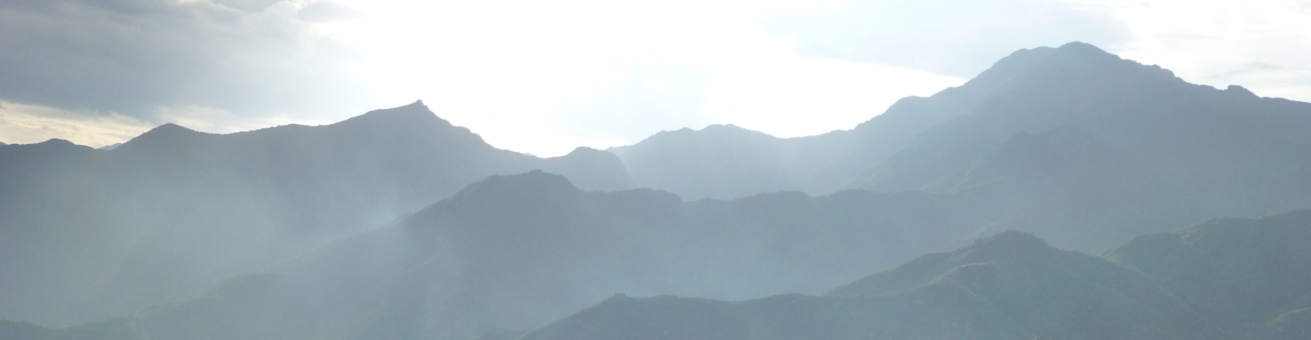
The next day, it was time to start our last, and most amazing, trek of the vacation. Unlike our previous trips, where we basically hiked in a single direction (north to south in Italy, east to west in Austria), this trip was a mess. We kept to the relatively small area known as the Alpstein, but covered most of the major highlights, going up and down each ridge and valley. (OK, not each, but a lot! Of course, I could easily go back and find another dozen days of hiking there without too much overlap. Maybe next summer…?)

Day 1 started out all wrong. We got to the train station and were greeted by a mob of middle schoolers. It was like a nightmare from a former life, but in German. (Actually, to be fair, they were excited, but generally reasonably well-behaved.) Once the train was moving, it dawned on me — they’re probably going exactly where we’re going: 30 minutes down the track to the cable car up to Kronberg. Ugh.
It turns out, I was only half right. They got off with us (groan), but when Jessica and I skedaddled out of there to get to the cable car first, and hopefully up the mountain before the kids were successfully herded in the right direction, it became evident why they were there: there’s a huge ropes course at the base of the cable car, the perfect beginning of the year bonding activity for a bunch of crazy Swiss kids.
Nevertheless, our cable car up was crowded for two reasons. First of all, there was a stack of lumber taking up a third of the space (easiest way to transport stuff up to the top). And, secondly, a big corporate group got on at the last minute, crowding us into the corner. This was an interesting phenomenon that we observed in multiple huts throughout our time in Switzerland. Lots of them have spaces that function as corporate retreat meeting rooms and school group classrooms. In a way, this makes sense, especially for the ones near cable cars or roads — it’s a nice place to spend a day or two, but not too far from the city.
So, so far we had survived a crowd of kids and a crowd of office workers. Up next: no crowds, just clouds. We emerged from the building at the top of the cable car and walked out into a dense white fog. It wasn’t pouring, but it was pretty wet and cold.

It was also a little sad. I had planned this first day as a nice intro to our trip. We were starting on a low mountain at the edge of the Alpstein area, and I had hoped that walking along this ridge we would get a good view of the region we were heading into. Over the next several days, I think my concept was proven correct, as we had multiple occasions where we could see back to Kronberg and some of the other recognizable spots we hiked past the rest of that first morning. Nevertheless, being in the middle of a cloud we had pretty much no view for the first few hours.
And, to top off our mediocre morning, as we started hiking along the gravel road heading out across the top of the mountain, I noticed that I could really feel the rocks through my shoes. A few days earlier, I had commented to Jess that I thought I might throw my boots out at the end of this trip rather than bringing them back to the States since the treads were starting to get pretty worn down. So, I wondered, were the shoes in worse shape than I’d thought?
Nope. Nothing like that. I was just an idiot. I’d left my insoles in my sneakers at the B+B in Appenzell. Whoops. I have custom insoles (which have really helped with the knee troubles I had throughout the sabbatical year), but for the first time ever, I had forgotten to switch them from one pair of shoes to the other. So…new experience. I’ve never walked in shoes without insoles before. It turns out to be, well, not great!

Luckily, most of the walk that morning was grassy and muddy rather than rocky, so it wasn’t too hard on my feet. About an hour down the trail, we came across Berggasthaus Ahorn. There, we got some recommendations from the hut staff about how to get back to Appenzell most easily, the main suggestion being to take care of it from the next hut down, Waldgasthaus Lehman, where there was a reasonable road for a taxi to come up and get us.
30 minutes later, we arrived at Lehman and promptly took a wrong turn, walking into a corporate retreat. (I told you there were a bunch of them!) After finding our way to the restaurant part, we convinced the staff to call the “public car” for us. This is a public taxi service that charges based on the rates for regional transit-based travel. It took a few tries, but I finally got an English speaker on the phone and made arrangements for them to come get me in two hours…
…but, as soon as I got off the phone, one of the employees there, Jael, quickly told us that this was a very bad plan. It was about 11:00 then, and Jael said that the cows would be coming down the mountain around noon. So, we had about an hour to go into Appenzell, get my insoles, and drive back to Lehman before the road would become nearly impossible to drive on for the rest of the afternoon.

Regula to the rescue! One of the owners of the hut, Regula, was there and suggested that Jael could drive me. Jess stayed with the bags and had a coffee while Jael and I took the 15 minute drive to Appenzell. I ran into the B+B (luckily they change the front door code at noon each day — just made it!), grabbed my insoles, dashed back to the car, and Jael zipped me back up the road.
Phew! Disaster averted! Huge props to Waldgasthaus Lehman for all their help!
By the way, it’s worth noting that we never saw the cows that day, but we sure heard them. Lehman is deep in the valley between Kronberg and the main part of the Alpstein region, so once we left there, we were headed steeply uphill. We were quickly into the woods and well above the valley, but about 20 minutes into our hike, we heard a ton of cowbells below, and continued to hear them until we rounded the corner away from the valley.
…And those were the last cows we saw or heard in Switzerland. After weeks of being surrounded by the sound of cowbells and having to negotiate our way around grazing bovines, they were just gone. It was late enough in the summer and starting to be cold enough that it was time to bring the cows down to lower elevations, so all of the farm houses and fields we passed through the rest of the week were vacant.
One other quick note on Lehman. Right before we left, the clouds parted for a moment and we got a bit of a view up at the first ridge of the Alpstein…

I was right that the view would have been spectacular. But, at least we got to see that whole ridge up close and personal the next day…
The rest of our hike that day was a pleasant wander through the woods…with boots that worked. We had few views, but did see a ginormous snail and some crazy mushrooms.


Eventually, we arrived at the very cool Gasthaus Aescher. (You can read more about our stay at Aescher here.)
(A small note on the map above — each of the little hiking symbols is the start of a day’s hike, with the exception of the second one. That’s where Lehman is. I stopped our hike tracking there and started again when I got back. Just in case anyone is using that map to follow the descriptions…)


But Aescher wasn’t the only thing built into the limestone cliffs here. The whole Alpstein is littered with caves, and right around the corner from Aescher, a small one, Wildkirchli, has served as a chapel since the 1600s. The cave next door was a hermitage for some time as well. Now you can hike through there (literally out the other end), stopping to see the side room that Aescher uses as a naturally-cooled walk-in refrigerator.


One thing that’s super-cool about the Alpstein can be seen a bit in that last photo above. This mountain chain is basically the northern edge of the Alps. Whenever we could see out to the north, it was low grassy hills as far as the eye could see (which was as far as Bodensee/Lake Constance and Germany to the north and out to Lake Zurich in the west).
Looking the other direction, from the front deck of Aescher, we got our first really good view into the interior of the Alpstein. This was why we came here! Check this out:
Breakfast at Aescher was full of delightful little snacks and that set us up for a truly epic day ahead.
While Outdoor Active usually displays our “moving time” once I’ve recorded a hike, I much prefer to look at the total time start to finish. Usually, including all the stops and starts, rests and photo opportunities, we often end up moving somewhere around 2 miles/hour, or somewhat less when we’re backpacking with full packs at 10,000 feet of elevation.
Well, here, we had no such excuses, but I think we recorded our slowest-moving day in history. Overall, we traveled 6.1 miles over a period of 7.5 hours. Ouch. Now, to be fair, we took a few long breaks and I took (stops to count…) 3,512 photos over the course of the day. And, as you will see, there were other reasons. But, still, that’s pretty dang slow.
Anyhow, the day was divided into three major chunks.
The first section of the hike had us overlooking one of the major valleys of the Alpstein with the Seealpsee (does that mean Alp-lake Lake?) at the bottom. We started out skirting below the top of the ridge from Aescher, eventually climbing up to the top at Schafler. From there, a series of cables and ladders kept us hugging the wall as we traversed along the top and side of the Schafler ridge towards Altenalp Turm, one of the most spectacular rock structures I’ve seen. Meanwhile, across the way, a giant rise held the Meglisalp hut that we would visit a few days later, with a nearly trapezoidal megalith jutting out above there, seeming to hang in the middle of the wide valley. Behind Meglisalp, one of the highest peaks, Altmann, loomed, and at the head of the valley to the southwest, the tallest peak in the area, Santis, was topped by a giant tower and a very odd building. Our goal for the day was on the far side of Santis. At the far eastern end (and actually another ridge over), we could see our destination for a week ahead: Hoher Kasten, from which we would eventually take a cable car back down to civilization. Meanwhile, at the various points when we were atop the Schafler ridge, we could see Kronberg, where had started hiking the previous day, out to the north. At the end of this gorgeous ridge hike, we stopped for lunch at the Lötzisälplisattel (a “saddle” is a pass) before heading out on the next leg of our journey.

Hoher Kasten at far left 

Altmann 
Hoher Kasten’s out there! 
Altenalp Turm (and Santis) 
Altmann 
Altenalp Turm (and Altmann and Santis) 
Altenalp Turm (and Altmann and Santis) 
Along Schafler Ridge 
Altenalp Turm 
Schafler Ridge 
Steckenberg (and Altmann) 
Schafler Ridge, Seealpsee, and Hoher Kasten 
Above Lötzisälplisattel 
Hoher Kasten 
Schafler Ridge 
Altenalp Turm (and Bodensee) 
Altenalp Turm
Did you look at those pictures? Is that landscape not completely awe-inspiring? The way that these mountains at the end of the Alps had been folded up and then hacked apart over millennia was absolutely nuts. Moving on…
The next chunk of our day sent us on a steep climb along the outside of the northern ridge of the Alpstein region. Over here we saw a number of ibex grazing–their horns are just incredible!


We then passed over another little saddle that brought us to the maddeningly twisted landscape below the peak of Santis. This region was a mess of boulders that involved as much scrambling as hiking, definitely slowing down our overall speed. It was also super fun.
The most interesting feature of this section was the holes. This entire region is made of limestone. That’s the same kind of rock that makes the amazing karsts you see in places like Ha Long Bay and other parts of Southeast Asia and also the same rock that makes Missouri home to nearly 3000 caves. So, it wasn’t surprising to see that the Alpstein had caves (like Wildkirchl, above). But, here (and at several places along this trek) this took the form of giant holes in the ground. You could lean over some and look down 40 or 50 foot straight drops into the earth. In other places, we hiked over large boulders that were clearly creating natural bridges across pits beneath us. It was amazing and a little nerve wracking.
Eventually, our hike/scramble/attempt-to-make-forward-progress got even steeper and this section ended with a nearly vertical ascent of one of the ridges extending out from the peak of Santis. Cables and the occasional rebar ladder helped.


At the top, we were crossing yet another pass. Most people at this spot took a left and climbed along the ridge and up the “sky ladder” to the top of Santis. We, instead, continued straight down the other side for the final leg of our day. It was only another mile or so to Berggasthaus Tierwis, but it was slow going. Whereas the ascent to the pass had had cables and such to help, the descent on the other side did not, and at points the footing was very, very narrow, with sheer drops below. Honestly, I didn’t get a ton of pictures in this chunk because there wasn’t a lot of time where my hands were free. It was a lot of holding the wall, or giving Jess a hand scrambling down something or occasionally trying not to get pushed off a cliff when someone went by in the other direction. (We climbed back up this 2 days later — it was significantly easier going up!) As we descended, passing under the Santis cable car, it looked something like this…


After the steep descent, the last little bit was just a rocky hike down to Tierwis. Along the way, we saw some fossils and also passed some folks practicing their climbing skills. (We saw them at the hut later; they were preparing for a more tricky expedition the next day.) Eventually, we arrived at Tierwis, balanced on the ridge between another wonderland of rocks and a steep drop to the valley below, outside the Alpstein.


So, that was our epic day. Lots of crazy rock scrambles up and down and around. And killer views in every direction.
(BTW, I exaggerated. Just so you know I’m not completely insane, it was only 292 photos that day. Still a lot, but not quite so ridiculous…)
Tierwis was a great old hut. It was the only place we stayed two nights in a row in the mountains. Our first night, a Saturday, the place was full of people doing the climb from the valley up to Santis over two days. Then, on Sunday, we were the only ones there.


That Sunday was a bit of a good news/bad news kinda day. We had been planning to do a 9-mile circuit that would have been a chance to use the via ferrata gear we bought in Innsbruck and had been carrying with us through the Alpstein just for this day. (If you don’t know what a via ferrata is, here’s a bit from when we did one in 2021.) That circuit would have meant doing the descent from Santis to Tierwis for a second day in a row. So, good news: we didn’t have to do that. Bad news: we didn’t do the circuit because it was absolutely pouring from about 1am until well after lunch. Good news: after the previous day’s crazy adventure, we were wiped, so the rest was nice.
Anyhow, it did clear up in the afternoon and we took a little one hour leg stretcher with a little off trail rock scrambling. The rocks here were worn to sharp points that really reminded me of Ha Long Bay, where I cut my foot on one of those rocks while swimming. Eventually, we had some pretty nice views of the crazy lego-like structure on the top of Santis. But, mostly, we just spent the day chilling, reading, and playing games.


After our rest day, we had another pretty epic day the next day…though part of what made it take a long time was completely self-imposed. Overall, we were hiking almost all the way back to Aescher, but this time dropping all the way to the Seealpsee, the lake at the bottom of the valley.
After the rainy day, Monday was pretty sunny. We started by retracing our steps, climbing the ridge below Santis. Then, rather than descending the other side of the pass, we turned right and climbed the “sky ladder” up to the top. This was basically a very easy via ferrata: a series of cables and footholds provided support in getting up to the peak. However, since we had bought the via ferrata gear (and also because Jessica gets just a little nervous sometimes), we decided to use it on this section, wearing our harnesses and clipping onto the cables. Literally no one else we saw was doing this, and it meant that we had to stop and clip and unclip a lot, so that slowed us down, but it was definitely safer. (If you’re interested, we watched this video about how via ferrata gear works. It’s a little frightening.) Here’s a bit of what that climb looked like…


The weirdest part was when we got to the top. We expected to have some sort of way to hike up to the building. Instead, we got this…

After wandering the tunnels, we eventually got up into the most sterile and dull mountain-top structure I think I’ve ever seen. At least we had a nice tea break there. The cool part of the building was outside — there were decks where you could see for dozens of miles in every direction. You could easily see a large chunk of Switzerland, most of Liechtenstein, into Germany and Austria, a tiny bit of Italy in the distance, and, supposedly, if you really squint, maybe to Mont Blanc on the edge of France (but I’m not sure I buy that one). The cool device Jess is standing next to allowed you to look through and would label the mountains that you could see through the lens. It was a spectacular spot on a gorgeous day.


From Santis, we went along another crazy ridge hike, following another intermittent via ferrata to Berggasthaus Rotsteinpass, right at the base of the next tallest peak, Altmann. Again, we didn’t really need the via ferrata gear, but used it some, slowing us down, but increasing our safety. Regardless, it was a fun little adventure going up and down and around the narrow ridge connecting Santis to Altmann. We went by the hut (and the herd of ibex there) and plopped down on the grass for lunch just below the pass.


From Rotsteinpass, it was an easy downhill walk to giant hanging valley of Meglisalp, where we stopped for a quick drink before our final descent.


By the way, to try to connect the dots, if you look at the “from above” picture there, the deep dark cleft in the background, that was where we paused for lunch between Aescher and Tierwis, i.e. the divide between the first and second “chunks” of that long day of hiking. So, in that photo, to the right is Schafler Ridge, and the ridge on the left is the one we went on the backside of where we saw the ibex. In the “from below” photo, you can see up towards Altmann, and Santis is hidden in the clouds in the background.
One of the funny things this day was the trio of people we leap-frogged multiple times after Rotsteinpass. A woman and two teenagers, her daughter and the daughter’s boyfriend. From Meglisalp, Jessica and I walked a good chunk of the next leg with the mother, an American whose parents had owned a home in the Appenzell area when she was growing up. She now lives in England, so her daughter had a crazy mixed-up accent. We saw the two kids again right at the end of the last day of our trek, as we crisscrossed the area in different ways.
Anyhow, the hike down from Meglisalp to the Seealpsee was steep! It took us down a cliffside, past large dripping overhangs, and eventually into the deep woods before we emerged at the bottom of the valley. There, we circled the Seealpsee before arriving at Forelle, which was more like a hotel than any of the other huts we stayed in. It had an amazing spot on the lake with a view back up towards Meglisalp.


And one more time, for perspective, look at the first photo above. The cliffs in the back there are where Aescher is. And the third photo again shows the end of Schafler Ridge again (also in photos 2 and 3 in the next set). As I said, we really covered the ground here pretty thoroughly, weaving back and forth and up and down throughout the territory.
The next day was our shortest hike both in terms of time and distance. From Forelle, we wandered down the valley a short way, then took a sharp right, climbed straight up to the narrow pass at Bogartenlucke, At the top we found the tiniest snails ever, but that’s about all we could see because we were right in the middle of a cloud. From there we dropped straight down an even steeper trail on the other side of the ridge. We eventually reached another wide valley with another big lake, the Samtisersee. The valley was almost as lovely as the previous one, though a touch less dramatic, but the Samtisersee was pretty disappointing after the lovely Seealpsee. The Samtisersee was basically a shapeless lump of water in the middle of the valley. Oh well. They can’t all be stunning.


Just above the Samtisersee, we stopped at Plattenbodeli. There, a group of 6th graders and their teachers were spending the week in the mountains. They had a separate little dorm building with a classroom, so we really only saw them at dinner and breakfast. This might have been our most boring hut in terms of location (not great views, too many trees around), but it was still a pleasant place to spend the afternoon chilling with a drink and a game.
The next day, our second to last (oh god, it’s almost over! ack! real life isn’t far off!), was another absolutely gorgeous hike. From Plattenbodeli, we retraced our steps up the valley, past the trail up to the Bogartenlucke. From there, we rounded the corner to Berggasthaus Bollenwees at the foot of the (so much prettier!) Fahlensee, a long narrow lake with steep cliffs on both sides. After relaxing at Bollenwees through lunchtime, we hiked past the Fahlensee (and a hunter carrying a dead chamois!) and then made a steep ascent up the valley until we reached the back side of Altmann and the absolutely stunning view from Zwinglipasshutte.


I loved the sharp shiny silver fins we passed throughout the day, and the lake was absolutely amazing. As I’ve described, Zwinglipasshutte was a really special place. We had a good time hanging out with the hut volunteers and also a good group at our table. The funniest thing was that one of the people we were sitting with had been our waitress at Forelle two nights earlier. They are closed on Wednesdays, so all the crew get either Tues/Wed or Wed/Thurs off, and the ones (like her) that don’t live in the area, use their off days to explore.

But the best part of Zwinglipasshutte was outside. From the deck we could see the back side of Altmann to the north, southeast as far as the Dolomites (seriously!), and right across the valley from us, the awesome sweeping peaks of the Churfirsten range. We kept going out to get one view after another as the light changed…


Finally, our last day of hiking was upon us. From Zwinglipass we were headed back to the northeast, paralleling the valley we had gone up the previous day, first on the other side of the ridge from Fahlensee, past Saxerlucke, and then on the top of the ridge above Samtisersee, eventually to the cable car on Hoher Kasten.
We started across a high plateau (with the occasional open pit to avoid), and eventually dropped into the Roslenalp valley. The sharp ridge on the south side dropped away at Saxerlucke so we could see out to the Rhine and Liechtenstein. From there, we climbed to the top of the ridge, stopping for lunch at Berggasthaus Staubern. From Staubern, a cable car drops steeply to the flat Rhine Valley below, which was protected from avalanches by a vast array of wooden barriers on the mountainside. From Hoher Kasten, we got amazing views back up the valley of the Samtisersee and the entire Alpstein region beyond. It wasn’t as thrilling as some of the previous days of hiking, but the views were pretty vast on a nice clear day.


At Hoher Kasten, there was a hokey “you’re traveling through the Earth with fake magma flowing around you” tunnel to the top of the cable car, but the view from the bottom looking back up was quite idyllic with the farms out front and the mountains behind.


Before we move on…let’s take one more look at that view from Hoher Kasten at the end. From that spot, we could see most of our first two days of hiking and almost the entirety of our last three days. Rotsteinpass was just barely out of sight and the Seealpsee valley was hidden, but pretty much everything else could be seen. This is part of what made this area so fascinating. It’s a tight little unit, sticking up at the end of the Alps by itself, largely surrounded by low hills and separated from the nearby mountain ranges by large flat valleys.
In this view you can see: (1) Kronberg, where we started, (2) Aescher, where we slept the first night, (3) Schafler Ridge and Altenalp Turm where we hiked the first day, (4) Santis, the highest peak, (5) Altmann, also tall, (6) Zwinglipass, where we spent the last night, (7) Saxerlucke, the pass between the interior of the Alpstein and the Rhine Valley, (8) Fahlensee, just out of sight, (9) Bogartenlucke, the pass between the two major Alpstein valleys, and (10) the Samtisersee, the least lovely lake. Pretty incredible to have so much adventure tucked into such a small area.

Anyhow, all adventures must come to an end. From Hoher Kasten, we braved another group of school kids (more like 4th graders, I think) on an overcrowded bus and then on our train back to Appenzell, where we did little other than shower and eat the rest of the day.
The next morning we took an early train to Zurich, where we spent the day wandering aimlessly, poking in here and there, but doing relatively little of import. It seemed like a pretty pleasant city, and the part along the lake had a fun vibe. We also spent some time looking around the shops and market tucked under the viaduct. The older parts of the city, with their twisty, narrow pedestrian streets were also particularly nice. A few favorite sites:
- A statue of Charlemagne in the crypt below the Grossmunster church, which also had interesting stained glass,
- A terrifying fountain, where someone had painted dripping red eyes on the statues of children, and
- A parking space that had been turned into a mini croquet green — anarchy in action!


And that was that. We got up around 5am the next morning, took a train to the airport, flew to Barcelona, and, from there, home. A fabulous month of hiking in the Alps. I’m sooooo ready to go back again.