
After our Venice wanderings, Jessica, Mark, Sue, and I caught a train headed north to Bolzano, one of the larger towns in the Dolomites. We had used Bolzano as our base for adventure in 2021 as well, so were excited to head back there. Like our previous visit, we spent our time wandering the cute downtown and enjoying the good food. We stocked up on chocolate and other hiking snacks while also perusing the outdoor gear stores.

However, unlike our previous visit, we had friends to see here! You may recall all the way two posts ago, when Jessica and I were in Chicago, we caught up with Michele, one of the women I hiked with in the South Coyote Buttes. Well, the other two, Dani and Irene, live in Brescia, Italy. I had hoped to stop by Brescia between Venice and Bolzano, but they were busy hiking in the Dolomites! So, instead, they came into Bolzano and met us for drinks and dinner. Dani is so ridiculous — she instantly began planning Sue and Mark’s trip to Lago di Garda (planned for after hiking in the Dolomites), and the four of them ended up meeting up for a day in Brescia later on.

The four of us rolled out of Bolzano the next day and got to our first hut (Starkenfeld) by way of a train, two buses, and the easiest 3.5 miles of hiking we saw over the next month. We didn’t have time to see much of Brixen, but we had plenty of time to wander the tiny town of Muhlbach.

Honestly, the best part of the day was the transit. Not that the hiking was bad, but I’m just completely in love with the fact that you can take transit to all sorts of great hiking spots all over Europe, particularly in the Dolomites. Our bus from Muhlbach gained over 3000 feet of elevation, ending at a parking lot high up on the mountainside. And this bus ran every hour or two throughout the day. Anything like that in the US would be once a day at best. The accessibility of hiking is top notch — and I think that’s probably part of what makes running Alpine huts a viable concept. (It’s almost like investment in public infrastructure helps people spend their money supporting small businesses. Crazy idea, I know.)
[NOTE: Throughout the rest of the hiking description, I’m keeping discussion of accommodations minimal. If you want to know more, read the 2121 and 2025 posts about huts.]
Along the hike from the Zumis parking lot to Starkenfeld, there were a series of sculptures representing the seven days of creation. My favorite was the sun, moon, and stars. (Though, the last one, “rest,” was funny — a bench outside of a small chapel.)

The rest of day 1 was a slow meander through fields and woods with a bit of light rain as we arrived at Starkenfeld. The rain kept us from enjoying the hot tub there and our laziness kept us from exploring the cheese-making operations in the barn a mere 100 feet away from the hut. Starkenfeld was probably the fanciest place we stayed all summer and the food was ridiculously good.
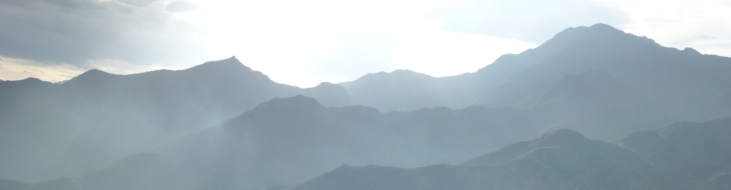
The next day’s hike was similar. In and out of the trees, across numerous fields, all over a long, low, rounded mountain ridge. As we hiked on, we could see glimpses of the more dramatic parts of the Dolomites in the distance, but the area we were in was quite pleasant and less filled with insanely spiky rocks. Those were another day away.


Our glimpses got fewer and fewer as the second day went on and the clouds continued to gather in the valley below us and the sky above. Surrounded by cows, we gazed out into unending fields of gray.
By the time we were getting close to Mauerberg, our second hut, the mist and drizzle turned to heavier and heavier rain. To add to the drudgery of the last mile, a number of cows decided to block our path. It took Jess some work to shoo them out of the way. Also, look at the expression on her face!

The nasty weather kept people inside at Mauerberg. This is where I learned that we weren’t the only ones hiking with games. Lots of cards and dice mingled with tea and beers as people spread out across the dining area. Skyjo and Cabo (variants of the card game, Golf) were games I saw there for the first time, but also numerous times over the next few weeks.
We woke the next morning to amazing view of Peitlerkofel, the peak we would be circling that day. We also saw the damage the wind had done to the flimsy outdoor furniture at Mauerberg.


Our hike that third day was one of the best days of our whole vacation. Yes, there was a brief downpour just before we reached Schluterhutte (just like the previous two days!), but the views throughout the day were stunning and the sun at midday was gorgeous.
From Mauerberg, we hiked downhill and crossed the road through the valley at Utia de Borz, where we stopped for a cappucino (it’s really lovely having these huts everywhere) before crossing into the Puez-Odle National Park. The next few miles were a gentle uphill to the foot of the mountain, passing yet more huts. The peak of Peitlerkofel was out of sight most of the time, hidden in the clouds, but the jagged ridge running out to the east and west were quite clearly visible — intimidating and amazing. Eventually, we made a steep climb over the Gomajoch, a pass on one edge of the ridge, dropping us into the Vaciara area on the southeast side of the mountain.


After stopping for lunch with a stunning view, we hiked around the south side of the mountain. We eventually had some views of the peak from the less dramatic, but still gorgeous, southern side. Also, note in the picture above (and also the one below, with all four of us in it), somewhere behind that giant rock wall is the area near Puezhutte, one of the most beautiful places Jessica and I hiked on our previous trip to the Dolomites. It’s always fun to try to figure out how different areas are connected, at least for me. I love mountains, and I love maps.
The area between the Gomajoch and Schluterhutte was dotted with little cabins and barns. We fantasized about buying one. It was ridiculously idyllic.


After heading right through a freakin’ cloud late in the afternoon, we arrived at Schluterhutte, one of the crowded Italian Alpine Club huts. We dried off and played cards while chatting with our table-mates, three Danish women hiking the entire Munich to Venice route.
Schluterhutte was also the first of many times that I made Jessica cry…by asking her to give me a beat like the music at the dance clubs that we always (never) go to. This became a running joke for the next several weeks. And it made her cry every time.

The next day, traveling from Schluterhutte to Rifugio Rasciesa, was the focal point around which we had planned our whole trip. This followed the Adolf-Munkel-Weg, a trail that skirts beneath the steep cliffs of the Seceda Ridge. Unfortunately, like our previous several days, our views were often obscured by clouds. But, they cleared enough at times to be able to glimpse the steep spikes and sheer walls above us. While not quite as gorgeous as the day before, it was still a pretty awesome hike.


Eventually, we passed the Seceda Ridge and crossed over to the next hillside where we strolled across to Rasciesa. This hut was located on a rather boring hillside, but with incredible views over Val Gardena and out across to the Alpe di Siusi and Sassolungo.


The next morning, we retraced our steps for a bit to get to the top of a funicular down to Uberwasser.

Uberwasser is a major base for hiking in the summer and skiing in the winter. It’s basically a sea of hotels and condos. But, the downtown was cute and there was a grocery store where we could buy a few more snacks for the rest of our hike.


From Uberwasser we continued the least hiking-y day of our hike with a bus ride to the town of Siusi and then a gondola up to the Alpe di Siusi.

The Alpe di Siusi (also known as the Seiser Alm, if you prefer the German name) is one of the most famous, and thus most heavily touristed parts of the Dolomites. There’s a large network of chairlifts through the area, dozens of huts and hotels, and a bus running through the middle of it. But, for as crowded as it felt at first, it was also serenely beautiful. After a little walk and a picnic, we took the bus to the end of the road at Saltria, a large hotel where we stopped for a drink while waiting for a shuttle to our destination for the night, Mahlknechthutte.


The oddest discovery was the huge parking garage at Saltria. It wasn’t obvious until you were right on top of it. A small entrance led to a vast underground parking area. It made me start to believe that all the action movies where the bad guys have a secret base hidden in the Alps might have some basis in fact.
Eventually, we got picked up and taken to Mahlknechthutte, where we found a pleasant view, an excellent meal, a comfortable bed, and a snuggly cat.


The next morning led to us parting ways with Mark and Sue. It was super-fun hiking with them, but Sue was starting to feel a bit tired after all the big climbs of the previous few days, and our next was scheduled to be the hardest day yet. They decided to stay an extra night at Mahlknechthutte and explore the area around there a bit more while Jess and I went on to the next hut. We would meet the following evening back in Bolzano.
We had planned our route through the Dolomites with an eye towards avoiding the steep drop offs that Sue dislikes. But, evidently, we had planned poorly. A few hours after leaving the Tafts behind, Jessica and I found ourselves in some pretty crazy landscapes. Now, to be fair, we had planned a slightly different route through the area, but when we got to the part where our original plan and our actual route met, we were relieved that we’d left Sue behind — she would not have enjoyed it!
That said, it was a pretty incredible day.
It started out with a crossing to the next valley over and a steep climb up a road we had hiked down four years earlier.


After stopping at the first hut we had ever visited in the Dolomites (Alpe di Tires) for a quick drink, we headed out into a wilderness of rocks and fog. To reach our destination, Rifugio Vajolet, we had to climb about 500 feet up to Passo Molignon, then drop down a steep, slippery, dusty trail down about 800 feet, before climbing back up the same amount to Passo Principe. Meanwhile clouds and fog swept through the area obscuring our views (which occasionally, incongruously, seemed to include a crane on top of the second pass). It looked something like this…at least in the moments the clouds lifted.


Or…if you prefer a panorama video:
The desolation of this area was such a huge change from where we had been over the last few days. We had seen rocky cliffs above and around us, but we’d largely been hiking through grassy fields and bits of forest. This was so different. Not unexpected (having hiked in the Dolomites before), but the rapid change from the early morning to the midday landscape was pretty shocking.
Eventually we reached Passo Principe. There, the crane we had seen towered over the tiny rifugio, building a huge new dorm building. The hut was built in such a way that a long, narrow deck provided views out to the crumbling mountainsides. We stopped for a quick dumpling soup (a staple of the region), along with about a million other hikers. The deck was narrow enough that we all had to line up our backpacks along the wall of the hut.


Rifugio Passo Principe was also the point where the trail we had planned to take with Mark and Sue joined the path we had taken through the wasteland between Passo Molignon and there. From the rifugio, we could see Passo Antermoia, well above us, that we would have had to descend to reach Passo Principe. It was a very good thing Sue wasn’t there. It didn’t seem quite as bad as the descent from Passo Molignon, but it wasn’t too pleasant looking.
From there, it was an easy mile or two stroll down the rocky valley to Rifugio Vajolet, our hut for the night.


There, we enjoyed our typical late afternoon: having a drink, a snack, and playing a couple of games of That’s Pretty Clever (or Twice as Clever or Clever 4ever — Jess won’t play Clever Cubed). I believe this was the first time I tried the “jagertee” that was on most mountain menus — a kind of spiced rum punch black tea situation. I enjoyed it and had multiple varieties over the next couple of weeks.

Our last day was a simple 3 mile downhill walk from Vajolet to the top of the Vigo di Fassa cable car. It was cloudy, but the views were still pretty incredible, including the light dusting of snow on the massive Piz Boe from the night before.


Along the way, we passed a number of huts (as I said, there’s more when you get closer to roads and lifts), including this fixer-upper which briefly induced a fantasy of running a mountain hut. The problem with that is that you get tied to one spot during hiking season. That doesn’t work for me. Fantasy dismissed.

When we finally made it down to the base of the cable car, it turns out we were still well above the part of town where we could catch a bus. We took an escalator down, then another, and, after a short walk, another…and another, then a short one, and a sixth for good measure, before we finally arrived in Vigo di Fassa.

After a quick coffee stop, we grabbed a bus back to Bolzano where we met up with Mark and Sue for an afternoon of doing almost nothing. A bit of lying around, some drinks and games, food, etc. I say almost nothing, because, as usual, I volunteered to do the laundry. When I arrived at the laundromat, I recognized it instantly. I’d been there in 2021 too. Full circle.
Overall, I don’t think this trip through the Dolomites was quite as mind-blowing as the previous one, but still, well worth it. The area is amazingly beautiful and varied. The huts are lovely. I can’t recommend it highly enough.
Anyhow, it was time to move on. The next day, Mark and Sue headed south to Lago di Garda while Jessica and I hopped a train to Innsbruck, Austria for our next adventure. More on that next time. Until then, I wish everyone as much sanity as possible in this insane world…
We are so glad we got to share (most of) this adventure with you!
Some of these photos make me relieved that I’m seeing them after you did the treks…yikes!
But so beautiful.