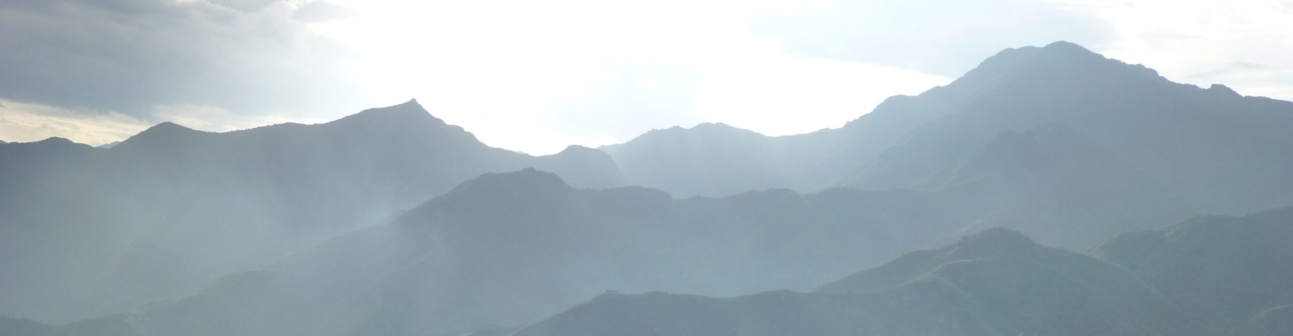

Jessica and I arrived in Innsbruck early in the afternoon and, after settling into our hotel, wandered the city while gathering bits of snacks and lunches to take on our next hike. We didn’t “do” much there (no museums or the like), but enjoyed wandering the cutesy old town and various other parts of the city. It was quite pleasant to walk around, as so many European cities are. Mostly, we were stunned by the location. Innsbruck is built in a relatively flat valley up against the base of some incredible peaks. The views in every direction were amazing.


We also enjoyed being able to eat in a major city both before and after our hiking trip. We had shawarma for lunch and dined at very nice Nepali and Japanese places, welcome changes from the Tyrolean cuisine of the huts. However, we avoided “Gringo’s Tacoria” (we know how to spell taqueria!), and were just amused by the art at the entrance to this sushi spot:


Innsbruck is also clearly a major center for outdoor activity, with a giant ski jump visible from the center of town, and pedestrian lights (in at least one spot) that looked like this:


The best part of this outdoorsiness was the Kletterzentrum Innsbruck, by far the largest climbing gym I’ve ever seen. We only poked our heads into the cafe and watched for a few minutes, but there were so. many. routes. Not only inside, but outside as well. Interestingly, they have very little top roping available — it’s almost all lead climbing (which Jessica and I haven’t done in years). Regardless, with my back acting up as it was, we didn’t bother to do anything other than watch.


Speaking of which, did I mention that I was having mobility issues all through this trip? For a few months, I had had some pain in my left leg that was clearly the same pain I’d had a few times before (2013/2014 and 2021) when I’d herniated a disc in my back. Well, suddenly, in early August, the pain switched to the right leg and massively intensified…right before we left Santa Cruz. For basically our entire trip, I had trouble getting out of bed, standing up and sitting down, tying my shoes, etc. (It was kind of comical when I’d get out of bed and take about 5 minutes before I could fully straighten up or take normal steps.) However, I found that, most days, once I was up and moving, as long as I didn’t sit much, I could keep moving. Each rest required another few minutes to get back into motion, but the pain wasn’t too bad as long as I was vertical.
[Note: Today, as I’m in the midst of writing this entry, I got a steroid shot in my back to help with the healing. Hoping this lets me get back to climbing, tennis, etc. soon!]
So, with my occasional hobbling in mind, Jess and I set off for the mountains the next day. From Innsbruck, we took a train about 20 minutes east down the valley to Schwaz, hopped off, and started marching uphill, first through town, and then up, up, up through the woods.

We didn’t hit any new records, but we did climb over 4,000 feet on that first day. The first chunk of the day was heavily wooded, so not a ton to see. Every once in a while we got glimpses of steep shiny silver mountains looming above, but largely, a ton of trees. It was pretty, but not stunning…yet.
The funniest thing we saw in the woods were two snakes. The first one was tiny and skinny. Jess walked right over it without noticing until I pointed it out. She glanced down and said, “oh,” and moved on shortly after. Much the same thing happened with the second one. Jessica walked right past (next to, not over, this time) a much larger snake, but when I pointed it out, instead of just noting it and moving on, she jumped and then ran back downhill past it to where I was standing. Nothing wrong with that, but Jessica is usually pretty fearless. Mostly, she was just surprised.


She was probably surprised because Jessica can get pretty spaced out while hiking sometimes. She’ll happily chatter with me if I start a conversation, but mostly she just walks. And, sometimes (I’d say often, but she’d disagree), she barely even notices the gorgeous surroundings we’re passing through. (I think that’s what happened in the snake situations here.) Of course, this means that Jess sometimes misses that I’ve stopped to take one of my couple hundred photos every day, and then another, and another, and that means she ends up a hundred yards ahead eventually. She doesn’t notice until I yell. Sad Gabe.
This is a contrast from when we were hiking with Mark and Sue. First of all, I can keep up with them. (They’re a bit slower than they used to be. Five years ago I could never keep up!) But, also, Jess gets more engaged with talking to them. They’re less boring. (In other words, she doesn’t talk to them 24/7, so there’s more new to say.) So, that generally meant that we hiked more as a group, or at least in pairs. I appreciated having folks to chat with. With just me and Jess, we mostly stick together, but she also just wanders off sometimes. Sad Gabe.
But, in reality, happy Gabe. Because as we emerged from tree level, the Naturpark Karwendel opened up. We found ourselves hiking up a steep-sided valley, until we reached a high pass at Lamsenjochhutte, a nice spot to rest and grab a cool drink while taking in the view just below the towering Lamsenspitze.


After a brief break watching people scramble down from the Lamsenspitze, we went on over the pass, scooted along a steep valley wall, over another small rise and then down a steep rutted hillside to our first hut, Binsalm. Binsalm was definitely a real working ranch, with a family living there. The food was pretty basic, but it was a great spot with a comfortable bed, so we were happy to get to chill there.


The next morning, we expected rain as we left Binsalm. Instead, the valley we descended into was just blanketed with clouds. We stopped briefly at Engalm, at the bottom of the trail before turning uphill to push our way through one of the thickest crowds of cows we’d yet encountered. The clouds occasionally blocked our mountain views, but also enhanced them at times, drifting around the peaks.


Eventually, we made it up to another low pass and dropped into the next valley. After spotting our first chamois of the trip (actually about a dozen of them), we climbed up to Falkenhutte, which had received rave reviews from other hikers and had a nice warming lunch.


Unfortunately, when we left Falkenhutte, the rain we had expected in the morning caught up with us in earnest. For the next 3 hours, we got drenched. I’m sure we saw some lovely things, or would have if it hadn’t been for the rain, but mostly, we were just trying to get through to Karwendelhaus. It was crowded, loud, and at least mostly dry. (More on our experience there…)


After we dried off a bit, had a drink, played a few games, and chatted with our oh-so-close neighbors, the weather began to clear. Over the later afternoon, evening, and the next morning, the views from Karwendelhaus were pretty amazing, with a light dusting of snow on the peaks around us.


The next day, we had a fairly easy descent following a dirt road about 11 miles into the little town of Scharnitz, right on the border of Germany. In fact, the whole hike from Karwendelhaus down followed the valley just a mile south of the German border, with the line of peaks just north of us marking the boundary.
For the first couple of hours of our hike, after our initial descent, we were deep in the fog hugging the valley floor. Sometimes it obscured the view. Other times, it added to the beauty.


You may have also noticed the mountain bikers in that last photo. There were a ton of them. I guess that’s to be expected on an easily accessible dirt road through a gorgeous area on a Saturday at the end of the German and Austrian summer holidays. Of course, that didn’t make it any less annoying.
Our other constant companions were the cows. There were a bunch of them. Interestingly, many of these were tagged with names, like this one, Franziska Barca.


At first, we liked to imagine those were the cows’ names, but I’m pretty sure they were marking some sort of ownership of who got the meat when they were slaughtered. Regardless, it made them feel a little more like individuals and less like a mindless mob of bell-toting super-poopers.
Eventually, we got past the cows and emerged from the fog, so we decided to take a short break to dry some of our still very damp clothing by the side of the river.
Honestly, while it was pleasant, it wasn’t the most spectacular day. Probably the most interesting part was when I failed as our navigator. I use an app called Outdoor Active to plan and track our hikes. As we were coming towards the end of the valley, I warned Jess that there would be a split in the road soon and we wanted to stay straight instead of turning left. About 20 minutes later, I wondered why we hadn’t seen that split. I assumed that the trail to the left probably had been small or maybe even non-existent (sometimes the mapping app and reality aren’t a one-to-one match), but when I pulled out my phone, I learned that we were well down the road we shouldn’t have taken. Whoops.
But, don’t worry. I found a “trail” on the map that cut back across from the road we were on to the one we wanted to be on. It just happened to go down someone’s driveway, out the back of their cabin’s property, and then into the woods where the “trail” kinda disappeared. Nevertheless, thanks to the beauty of GPS, the lack of a “trail” didn’t stop us…it just slowed us down, and we eventually made it down to Scharnitz.

There, we stopped at the brand new and very useful tourist office, where a very helpful woman assured us that, yes, Steniernes was a real hut where we would have a bed and food. She seemed a little surprised that we knew about it, but it was reassuring to hear that our goal for the following day was a real place. (Steinernes was still an amazing day’s hike away, but if you didn’t read about that crazy place, go for it…)

We spent the afternoon in Scharnitz enjoying the sun and a drink before checking into the little hotel we had booked. It was run by a very nice man who told us altogether too much about the history of the place, but this was made up for by his very pretty black cat.
Dinner in Scharnitz turned out to be a surprising challenge. The place we had spent the afternoon hanging out turned into a very upscale restaurant at night. We were not feeling fancy, so we went to the only other place that was open in town, a “fast food” restaurant with burgers and shawarma. However, when we got there, they told us it would be at least an hour and a half before they could even do a take out order for us.
Ridiculously, we figured the fastest way to get dinner was to take the train down to the town of Seefeld (I suggested we go north into Germany instead, just to say we’d been there), where we ended up at a fast food restaurant with a surprisingly similar menu that was literally across the street from the train station. But, with barely anyone there, it was actually fast. When you eat at “Pizza and Burger” you know you’ve had an authentic cultural experience, right? (Well, I did actually try something that is evidently a specifically Austrian fast food thing, a bosna — a type of sausage sandwich.) Anyhow, after our quick dinner, we hopped the next train back to Scharnitz and hit the sack.

So far, our hike had been in the “Naturpark Karwendel,” the area northeast of Innsbruck. After we left Scharnitz, we headed further west into the area above the Gaistal Valley.
We started the day the same way we ended the previous one…we took the train down to Seefeld. But, this time, instead of stopping for fast food, we caught a short bus in order to skip 3 or 4 miles of road walking. This part of our trek was thrown together after our first idea failed. Our original plan had us crossing over the border into Germany for the next few days, but the huts we were hoping to book were all full, so our hike this day to Steinerneshutte was a bit of a backup to the backup plan. Despite being unintended, it turned out to be an epic day — definitely the highlight of our Austria trek. There’s so much beauty out there, you just never know where you’ll find it.

We started by climbing from the flats of the Leutasch area up a steep choose-your-own-adventure mountain. There were a ton of different trails that all eventually ended up in the same place. We took one of the longer, but less heart-pumping options. Eventually, the trails converged around two huts, Wettersteinhutte and Wangalm. That’s where we lost most of the other hikers we’d seen. From this area we started to get a good view across the Gaistal to Hohe Munde, the dominant peak at the end of the Mieming Chain on the opposite side of the valley.

After climbing up above the huts, we reached a bowl just below the sharp peaks that divide Austria from Germany.

These two views dominated our day: Hohe Munde and its mountain chain across the valley, and the German border less than a mile away and about 1500 feet above us. Meanwhile, we passed through half a dozen of these high bowls, crossing over each arm of the mountains that stretched out from the barren ridge above.
Bonus! There was barely anyone there! At the start of our hike, there had been tons of older folks in the valley and quite a number of other middle-aged ones heading up to the first set of huts. But, once we were on the higher elevation trail, we only saw a couple of other folks. On the other hand, we did see a bunch of sheep in the first few bowls, including two that followed us for nearly a mile.


Anyhow, the rest of the day was stunning. A great sunny day, trekking high up on the ridge with views for miles.


Eventually, we arrived at Steinerneshutte, the oddest place we stayed on the entire trip. (Really, if you didn’t read about it, go here.) We spent the afternoon relaxing with the German hikers who had been out exploring the border peaks, enjoying a drink, and watching the light change on Hohe Munde.


Our next day was less epic, but more varied. From Steinernes, we crossed over to yet another bowl along the border. But, from there, we took a route up and down an unfortunately steep little hill (Jessica did not like it!), eventually dropping to a trail that we could have followed about 1/4 mile to the German border. We skipped that, but did get a good look at Zugspitze, the highest peak in Germany. Our original plan would have taken us along the valley below there. Looking at it, I’m not sure if that would have been better or not. The mountain itself wasn’t actually very attractive, a big pile of crumbly rock with (if you look closely) too much human development on it — lifts, huts, etc. Regardless, it’s still fun to be in these spots where you can see multiple countries! We don’t get that in the US much, do we?


From there, we turned south and dropped down towards the Gaistal Valley for lunch at Hochfeldern Alm. We crossed the valley and passed the lovely Seebensee, then climbed the incredibly steep trail up to Coburgerhutte, another Alpine Club hut where we spent the evening.
From the point where we passed the German border crossing all the way to the end of the day, there was a constant flow of people. This saddle between Zugsptize and the Seebensee (which is towards the far end of the ridge Hohe Munde is on) is littered with roads, lifts, huts, and all sorts of tourist infrastructure while hovering just above Ehrwald, a major hiking and skiing base. It’s also pretty beautiful, so I can’t say I blame people for wanting to be there. It was just a change from the private nature of the previous day.


I also want to mention one other thing from this day. MASSIVE ANT HILLS. We saw just tons of these incredible ant megalopolises. Fascinating and frightening all in one.

Our last day hiking in Austria was a straight drop off the mountainside. After grabbing breakfast, we made a short climb up to a small pass, Biberwierer Scharte, and from there dropped 3500 feet down an incredibly steep couple of miles of narrow switchbacks. We wandered through clouds from bare rock and dirt into patches of bushes (where we found better footing), before finally dropping into the forest. Finally, a long slow trail took us down into Ehrwald, just in time to get drenched by a passing storm.


After lunch, a train zipped us around through Germany, back past Scharnitz and Seefeld, and eventually to Innsbruck. We spent the next day there, relaxing and doing some shopping. After telling Mark and Sue that we definitely didn’t need any of the various water resistant hiking pants we had seen on sale in Bolzano, we decided that getting absolutely drenched in Karwendel (and again in Ehrwald) was sufficient reason to buy some “fancy pants” before heading off to Switzerland.
More on our last, and best, trek coming soon…